 |
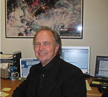
| Ken M. Morgan, Associate Dean |
The TCU Center for Remote Sensing
Department of Geology
Box 298830
Texas Christian University
Fort Worth, TX 76129
VOICE: (817) 257-7273
FAX: (817) 257-7789
EMAIL: k.morgan@tcu.edu
 |
| Ken M. Morgan, Associate Dean |
I currently hold the dual position of Professor of Geology and Director of TCU's Center for Remote Sensing and Energy Research. I have published numerous articles on geologic and environmental applications of remote sensing and GIS (Geographical Information Systems) and conducted seminars, conferences, and guest lectures in the U.S. and overseas (Egypt, Saudi Arabia, China, and Germany). Over the years, I have been the principal investigator for more than 50 funded research studies on the use of satellite data for resource mapping and a consultant for more than 70 companies. My lab was selected in 1990 as a National Workshop site for Landsat processing by EOSAT. I am also actively involved as a consultant for image processing and GIS projects with companies and governmental agencies.
I am a member of the American Society of Photogrammetry & Remote Sensing (ASPRS), the American Association of Petroleum Geologists (AAPG), and The Geological Society of America (GSA) and served as a Distinguished Lecturer for the Society of Petroleum Engineers, lecturing in the U.S. and Overseas (Saudi Arabia, Egypt, United Arab Emerites, and Italy) on the applications of remote sensing to resource mapping and management.
I am in the early stages of working with Dr. Newland to plan ECO-INFORMA 2001, which will be held at the Argonne Labs in Chicago next May. ECO-INFORMA 99 was held at Disney’s YACHT and BEACH Club Resorts Epcot, Lake Buena Vista, Florida. ECO-INFORMA 96 was held at Epcot in November of 1996 and was highly successful. This important conference had as its theme "Global Environmental Communications," and TCU co-organized the conference with the Environmental Research Institute of Michigan (ERIM) and ECO-INFORMA, a non-profit organization headed by Dr. Otto Hutzinger, Chair of Ecological Chemistry and Geochemistry, University of Bayreuth, Germany. ECO-INFORMA '96 was a major international conference focusing on environmental information and communication. ECO-INFORMA 97 was held in Munich, Germany, october 6-9 1997.


Morgan, K.M., L.W. Newland, A.B. Busbey, and E. Weber, 1994, Using SPOT data to Map Impervious Cover for Urban Runoff Predictions, J. Toxicological and Environmental Chemistry, Vol 40, No.1-4, p. 11-16.
Bittick,, S.M., K.M. Morgan and A.B. Busbey, 1994, Image Processing to Map Alluvial Fans on the Rosillos Laccolith in Brewster Co., Tx, ERIM, Proc. Tenth Thematic Conference on Geologic Remote Sensing, San Antonio, TX,Vol II, 151-157. Savell, S.J., K.M. Morgan, R.N. Donovan and A.B. Busbey, 1993, Using Landsat TM, a Spectrometer, and a GIS for Lithologic Mapping in Portion of the Eastern Slick Hills, Oklahoma Geology Notes, 53:67.
Busbey, A.B., K.M. Morgan, and R.N. Donovan, 1992, Image Processing Approaches Using the Macintosh, PE & RS, Voil 58, No. 12, pp. 1665-1668.
Morgan, K.M., A.B. Busbey, N.D. Donovan, and L.W. Newland, 1992, Image Processing and GIS at TCU's Center for Remote Sensing & Energy Research, PE & RS, Vol. 58., No. 8., 1173-1174.
Plunk, D., K. Morgan, and L. Newland, 1990, Mapping Impervious Cover Using Landsat TM Data. J. Soil and Water Conservation, 589-591.
Morgan, K., L. Newland, and S. Hayes, 1990, Hydrologic Assessment of Critical Erosion Areas Using Satellite Data and a GIS. In Progress in Astronautics and Aeronautics, Special Pub., Vol 128, (eds., F. Shahrohki, N. Jasentuliyana and N. Tarabzouni), 70-76 pp, ISBN 0-9303403-77-0.
Morgan, K. and L. Newland, 1989, Geographic Information Systems (GIS) for Environmental Data Base Management and Analysis. J. Toxicological and Environmental Chemistry.Vol. 26, pp 129-136.
Neven Trenc, Ken Morgan, R. Nowell Donovan and Arthur Busbey, 2000, Remote Sensing Analysis of Selected Terrestrial Impact Craters and a Suspected Impact Structure in South Korea Using Space Shuttle Photographs, Geologia Croatica, Vol 52/2, pp 203-211.
Margaret MacDonnell, Ken Morgan and Leo Newland, 2002, Integrating Information for Better Environmental Decisions, Environ. Science & Pollution. Res., 9 (6) 359-368.
Margaret MacDonnell and Ken Morgan, 2004, GIS and Cumulative Risk Analysis to Address Environmental Contamination, In Proc. of the 18th International Conf-Informatics, EnviroInfo 2004, Geneva, Switzerland, Oct 21-23, 2004, 246-249 pp.

