
Virtual Big Bend
Virtual Big Bend
Since these images can be rather large they are available as downloads rather than just shown on the page. At this time (2/25/97) I have four Virtual Big Bend scenes.
1). A view from the southern edge of 9 Mile Mesa, looking back towards the Chisos Mountains to the south. About 116K
2). An animated QuickTime flight (256K) (also notice the moving clouds). This starts out northwest of the 9 Mile Mesa. The 'plane' flies towards the mesa mountains then turns south and flies towards the Chisos Mountains.
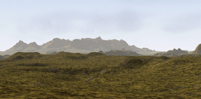
3) A QuickTime Virtual Reality movie (165K) from a position somewhat west of the Chisos Mountains. I have labelled several ranges in the picture. This is my first stab at a QTVR panorama (2/24/97). If you do not have a QTVR player or the QTVR plugin for your browser - you might want to pick them up for Macs or Wintel machines at Apple's Quicktime VR site.
4) Another QTVR movie (480K) that shows a virtual view from on top of Casa Grande in the Basin. It was made 2/25/97 and is better than the panorama in #3. I have also labelled a few of the more prominant features. This is based on a larger rendered strip so is smoother and can be magnified more than the QTVR in #3.
5) Another QuickTime animated flight (780K) in Big Bend. This flight starts in the vicinity of Persimmon Gap. You fly to the southwest and then bank and fly towards and over the Rosillos Mountains, across the Canoe Valley and Tornillo Creek towards the Sierra Del Carmen. Approaching the Sierra Del Carmen the flight turns west towards the Chisos Mountains and then flies over the Chisos Mountains (in a few cases through a peak or two) and then down towards the western edge of the park and Santa Elena canyon. The flight ends by flying into Santa Elena Canyon.
If you like the idea of flights of fancy then see the same flight path above but with Big Bend partially flooded Ocean Big Bend.
6) The newest QTVR - Emory Peak. This VR clip was actually rendered from a view point approximately 100 feet above Emory Peak - the third highest peak in Texas. Unlike the other clips I have not labeled any features in this clip. Enjoy! And thanks to Daniel Wright for the suggestion.. ;-) 7/20/97

